
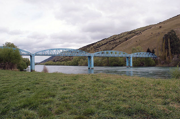
Millers Flat Bridge, Otago Region. Image courtesy of www.flickr.com | Shellie Evans - flyingkiwigirl | 10/05/2014 | Shellie Evans
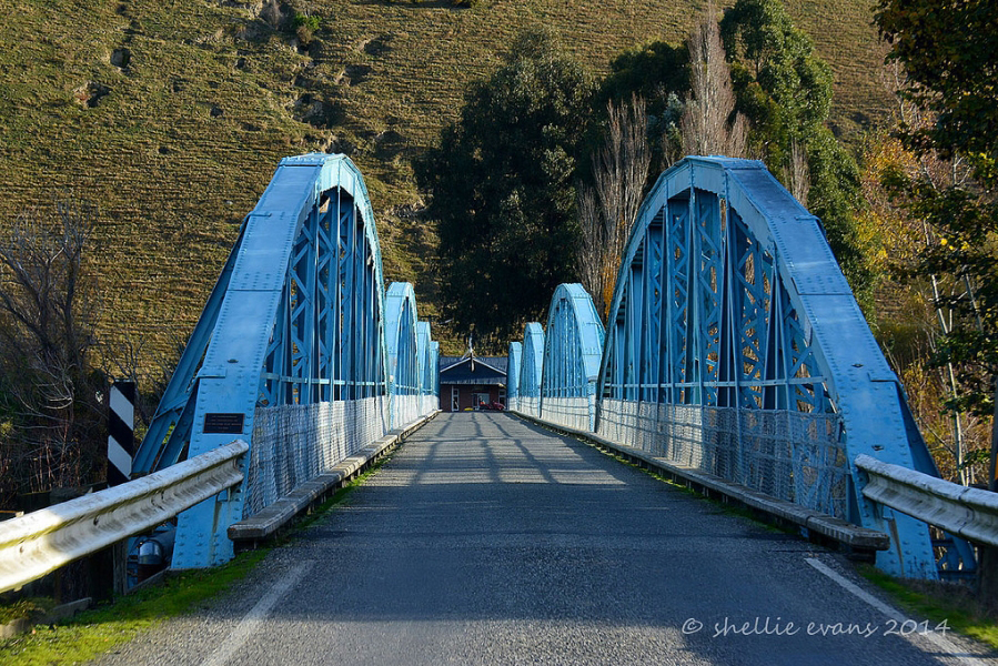
Millers Flat Bridge, Otago Region | Sarah Gallagher | 19/01/2023 | Heritage New Zealand Pouhere Taonga
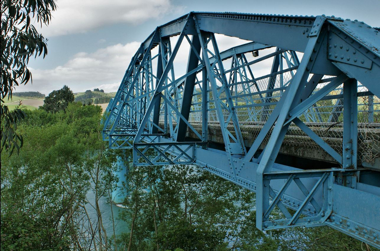
Millers Flat Bridge, Otago Region. CC BY-SA 3.0 Image courtesy of commons.wikimedia.org | Ulrich Lange, Bochum, Germany | 11/02/2017 | Ulrich Lange, Bochum, Germany - Wikimedia Commons
Millers Flat Bridge, Otago Region. Bridge detail. Image courtesy of www.flickr.com | PhilBee NZ - Phil Braithwaite | 28/10/2015 | Phil Braithwaite
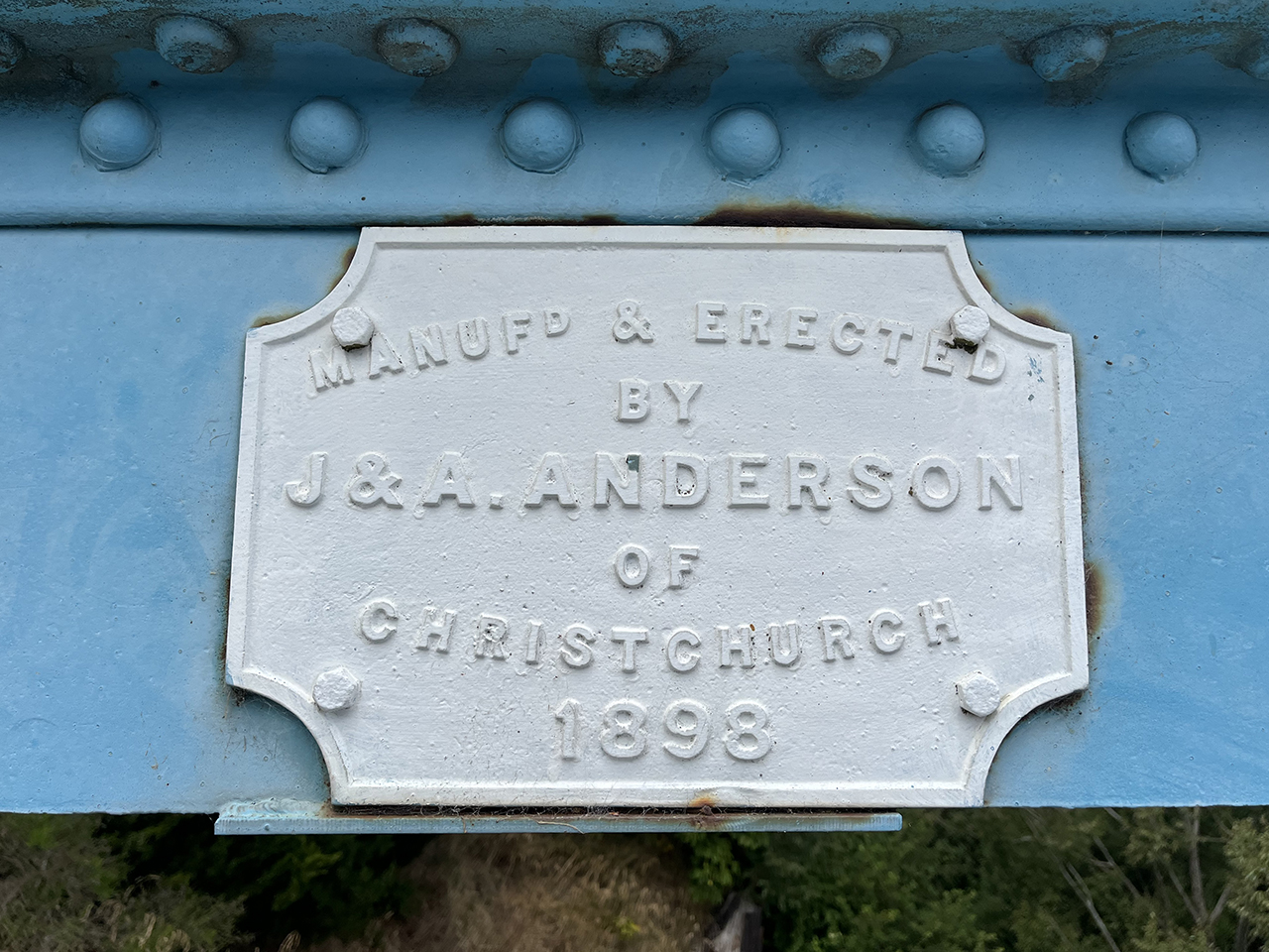
Millers Flat Bridge, Otago Region. Bridge detail | Sarah Gallagher | 19/01/2023 | Heritage New Zealand Pouhere Taonga
Millers Flat Bridge, Otago Region. Image courtesy of www.flickr.com | Shellie Evans - flyingkiwigirl | 10/05/2014 | Shellie Evans
Millers Flat Bridge, Otago Region | Sarah Gallagher | 19/01/2023 | Heritage New Zealand Pouhere Taonga
Millers Flat Bridge, Otago Region. CC BY-SA 3.0 Image courtesy of commons.wikimedia.org | Ulrich Lange, Bochum, Germany | 11/02/2017 | Ulrich Lange, Bochum, Germany - Wikimedia Commons
Millers Flat Bridge, Otago Region. Bridge detail. Image courtesy of www.flickr.com | PhilBee NZ - Phil Braithwaite | 28/10/2015 | Phil Braithwaite
Millers Flat Bridge, Otago Region. Bridge detail | Sarah Gallagher | 19/01/2023 | Heritage New Zealand Pouhere Taonga
Location
List Entry Information
Overview
Detailed List Entry
Status
Listed
List Entry Status
Historic Place Category 2
Access
Able to Visit
List Number
5217
Date Entered
19th April 1990
Date of Effect
19th April 1990
City/District Council
Central Otago District
Region
Otago Region
Extent of List Entry
Extent includes part of the land described as Legal Road and Legal River, Otago Land District, and the structure known as Millers Flat Bridge thereon. Refer to the extent map tabled at the Heritage New Zealand Board meeting on 11 December 2014.
Legal description
Legal Road and Legal River, Otago Land District
Location Description
Spanning Clutha River.
Stay up to date with Heritage this month